
Walk Fresno Addresses by Street
Fresno has no municipal clerk because it is an unincorporated Fort Bend County Census-designated place. A street-by-street search therefore begins with county tools. First normalize the delivery address, then use the parcel record to identify the situs address and the property account. The owner field can establish a tax-account relationship, but it does not establish who occupies a home. The useful trail moves from a standardized address to a parcel, then from the parcel to a dated deed or plat. Keep the address, owner mailing address, legal description, and each record date in separate notes.
The order matters. A postal result is only a routing clue. A parcel account can supply the legal description that survives an address change. A recorded deed can then identify the prior grantor or grantee. For a historical household question, a telephone directory or obituary may add a dated lead, yet it still needs support from a county record. This approach is built for an address trail, not for publishing a household list.
- Use the USPS ZIP Lookup to standardize the street spelling and postal form. Its address, city-and-state, and cities-by-ZIP modes do not confirm a person or company at the address.
- Search the Fort Bend Central Appraisal District by street number and name. Save the situs address, owner mailing address, legal description, Quick Ref ID, and Geographic ID separately.
- Open the Fort Bend interactive map, locate the parcel, and compare its subdivision, thoroughfare, MUD, floodplain, and other visible layers.
- Use the owner as a grantee lead in the County Clerk online record search. Record the instrument number, recording date, parties, and legal description before treating a document as part of the chain.
- For an older address trail, ask George Memorial Library about telephone volumes, newspapers, vertical files, and a possible reverse-directory lead. The collections themselves are described on the Fresno City Directory page.
Note: Preserve punctuation, hyphens, and road-name variants when searching, especially where a plat or an older document spells the same Fresno road differently.
Fresno Address Search Fields
FBCAD is the strongest first stop for a current Fresno address because it accepts both owner and property clues. The property search offers owner name, street number and street name, Quick Ref ID, Geographic ID, subdivision, neighborhood, condo or abstract, property type, agent ID, DBA, owner ID, tax year, hearing date, and board-member fields. For a street search, start simple with the street number and name. If the result is broad, shift to the subdivision or the account identifiers rather than guessing from a similar-looking address.
| FBCAD field | Use in a Fresno by-address search |
|---|---|
| Street number and street name | Locates a present property account from a normalized situs address. |
| Owner name | Finds an appraisal-account relationship, not proof of occupancy. |
| Quick Ref ID and Geographic ID | Preserve the identifiers for returning to the same account and comparing map records. |
| Subdivision, neighborhood, condo, or abstract | Helps distinguish newer plats from older survey or abstract descriptions. |
| Tax year and property type | Sets the appraisal context and avoids comparing mismatched account displays. |
The FBCAD property-search screen shows the address, owner, subdivision, and identifier controls that make a Fresno address search more precise than a loose name search.
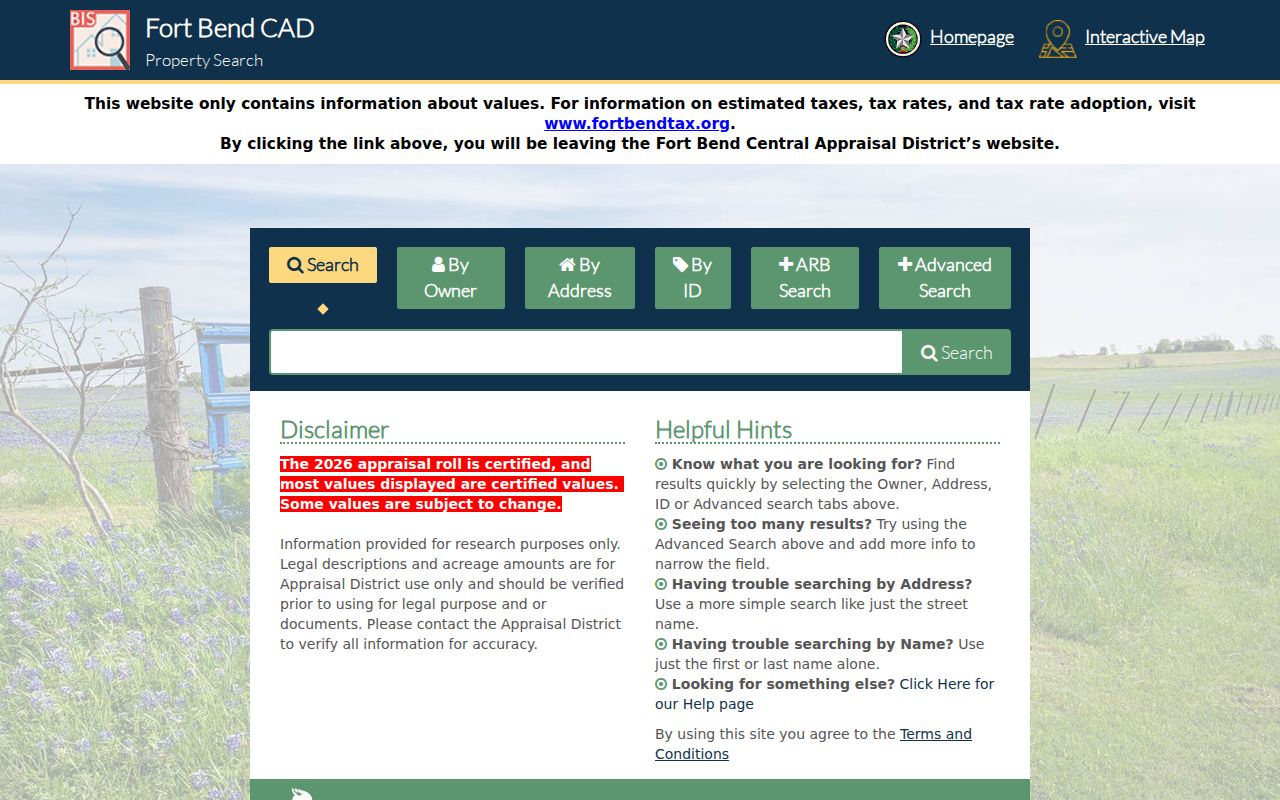
Use the account as a locator, then confirm its legal description and recording trail through the County Clerk. FBCAD says deeds arrive from the Clerk weekly, and it describes its value and legal-description data as informational rather than a title certification.
FBCAD also accepts a written open-records request by email at openrecords@fbcad.org or by mail when the public display does not answer a records question. Its guidance says it responds within 10 business days. Property owners may use the FBCAD web opt-out for name and mailing-address display, while underlying public records remain governed by law.
Fresno Property Account Scale
Fresno address research sits inside a large countywide appraisal system. FBCAD was established in 1982, and its homepage reports roughly 395,000 accounts and 225 taxing units in its 2024 value context. That scale explains why an exact street number, street name, subdivision, Quick Ref ID, or Geographic ID matters. A broad owner-name search can produce many unrelated accounts. A precise property clue keeps a Fresno search tied to a parcel rather than a name alone.
Use the displayed tax year and property type as part of the record note. Then compare the FBCAD result with the deed’s recording date and the GIS parcel context. The three records can describe the same land from different angles, but no one display should be read as a complete history of the people who may have lived there.
Fresno Parcel Layers by Street
The county map gives an address search its spatial check. Search the address with the magnifying glass, turn on parcels and subdivisions, and click the target parcel. The County GIS materials list parcel, subdivision, CAD, MUD, thoroughfare, floodplain, and mobility layers. Those layers can explain why two addresses on the same road belong to different sections or use different parcel descriptions. The documented reliable method is map browsing and parcel clicking, not an assumed radius or buffer tool.
After opening a parcel, record the parcel context, then click parcels that share a boundary if the question concerns the immediate block. Compare situs addresses, subdivision or section names, and taxing-unit codes. Open FBCAD accounts only for the parcels actually being compared. A current owner can be relevant to an ownership history, but an address record should not turn that name into an assertion of residence.
FBCAD’s official search help recommends simple street-name and name searches and explains the Quick Ref ID. It also warns that map information has limits.
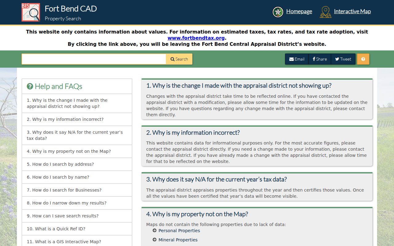
The help screen is a useful reset when a Fresno address returns no account. Try the core street name, then use the parcel identifiers or legal description captured from a matching result.
For a physical-address verification or a GIS data question, the county provides a GIS Request Form and Physical Address Verification Form. Completed PDFs may be emailed to the GIS Division. Ownership and appraisal questions belong with FBCAD, while flood and drainage questions route to the Drainage District.
Fresno Road-Range Boundaries
Trammel Fresno Road shows why a Fresno address needs a range check. The county street-range material includes a 130–1843 segment with Fresno and 77545 coding, then a separate 4203–4522 segment associated with Missouri City and 77459. A street name alone is not enough to assign the whole road to Fresno. Record the house number, ZIP, and the city or municipality code shown for that range before attaching a place label to a parcel.
This is also why a USPS city label, a Census-designated-place boundary, and a parcel jurisdiction should not be treated as interchangeable. Fresno’s 77545 postal anchor is useful, but it is not proof of municipal incorporation or parcel ownership. The county’s 2025 street-range file is a practical bridge when a deed, appraisal account, or older note uses a place name differently.
Search common variants as well: Trammel Fresno Road, Trammel-Fresno Road, FM 521 N, W Sycamore Road, and Teal Bend Boulevard. The exact form in a plat or deed can be the one that unlocks a historical result.
Fresno Records Searchable by Address
Address-keyed sources answer different parts of a Fresno street question. The appraisal account is the current parcel starting point. GIS supplies the map context. The Clerk’s index supplies recorded documents and parties. The county street-range file helps normalize location labels. Voter inquiry is narrower: it can support current registration context for a name and address combination, but it is neither a complete household roster nor a record of anyone’s ballot choices.
| Address record | Fort Bend keeper | What it can show | Access channel |
|---|---|---|---|
| Property account | FBCAD | Owner name, mailing and situs addresses, legal description, value, and taxing-unit codes. | Online search; written request by email or mail. |
| Parcel map | County GIS | Parcel boundaries, subdivisions, CADs, MUDs, thoroughfares, floodplain, and mobility context. | Interactive map; GIS request or address-verification form. |
| Official Public Records | County Clerk Records Division | Deeds, plats, mortgages, liens, easements, and recorded party names. | Online index; Richmond counter; mail request; copies. |
| Street-range file | Fort Bend County | Address ranges with ZIP, precinct-subdivision, and municipality coding. | County online material. |
| Voter registration inquiry | Elections/Voter Registration | Current registration context through the selected official lookup method. | Online inquiry; county office by phone, mail, or in person. |
Fort Bend Elections accepts the official inquiry by VUID, or by the selected name and date-of-birth method. Its office is at 3730 Bamore Road in Rosenberg, and it also accepts mail at 301 Jackson Street in Richmond. Protected fields and ballot secrecy remain outside a street-by-street inquiry.
Note: A parcel or voter result should be corroborated with a dated deed, official filing, or other independent record before it is treated as a match.
Fresno Deed Links by Street
A Fresno address search becomes a historic ownership trail at the County Clerk. The Official Public Records search offers Party Name, Grantor, Grantee, Date Filed, Instrument Number, and Document Type. For a property account, search the current owner as a grantee, locate the purchase deed, and capture the grantor, legal description, recording date, and any prior instrument reference. Search that seller as an earlier grantee, using the same legal description whenever possible. This prevents a changed street address from breaking the chain.
The County Clerk’s online-record-search route joins Official Public Records with other county channels and points researchers to the public search.
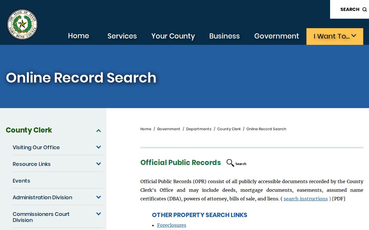
The online index is a lead rather than the official repository. Images carry an “UNOFFICIAL DOCUMENT” watermark, and the Clerk directs researchers to buy plain or certified copies when a copy is needed. Include the instrument number in a mail request to County Clerk, 301 Jackson Street, Richmond, TX 77469-3108. Clerk staff cannot perform legal research or give title advice.
The older grantor-grantee index interface illustrates the fields to preserve in a deed search: party, date, instrument, and document type.
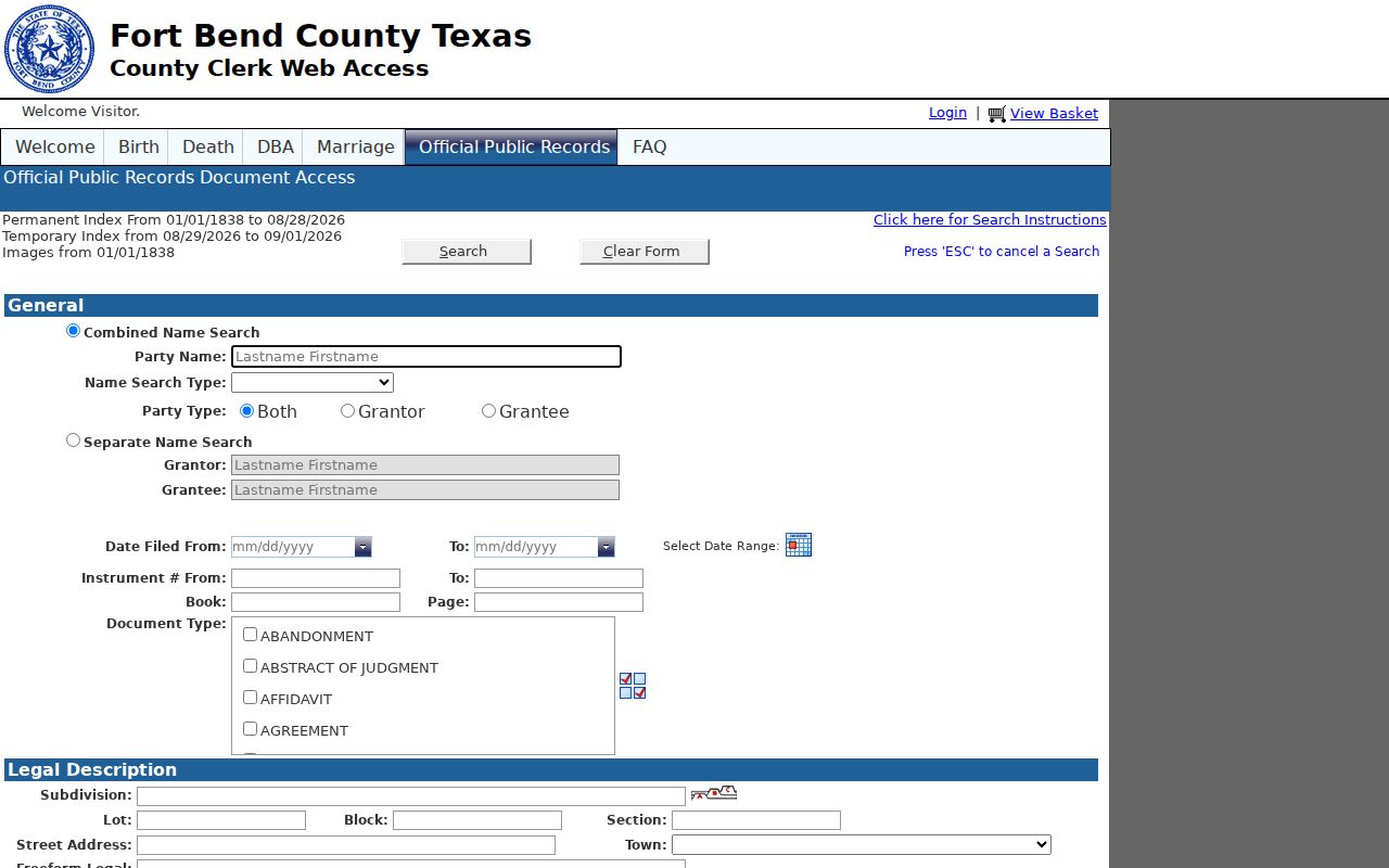
Do not mistake a deed of trust, release, lien, easement, or plat for a conveyance. Test the document type and read the recorded parties before inserting it into a chain of ownership.
Plain copies are listed at $1 per page. Certified copies are $1 per page plus $5 per document. The Clerk also offers in-person and mail channels, and the Sugar Land office provides property-recording and copy services. Check the current county contact information before a visit.
Fresno Address Eras by Street
Fresno’s Old Fresno and New Fresno labels call for two search habits. The county’s Livable Centers Study associates New Fresno with subdivisions such as Teal Run and Andover Farms. For those areas, start with a subdivision, section, lot, block, or recorded plat. Old Fresno is described as older linear development with vacant tracts and limited commercial or industrial activity. There, a road name may be less useful than an abstract, survey, historic landowner name, or deed description.
The legal description bridges both eras. Fort Bend County records predate modern Fresno subdivision development, and historical material may be indexed by county seat, survey, legal description, landowner, community name, or rural road. The County Clerk says historical records reach to 1821, while its online OPR library is described as 1838 to the present. Modern search fields are not proof that every historic image has been indexed the same way.
- Parcel
- A mapped unit of land in the appraisal and GIS systems. It is a location tool, not a household list.
- Situs address
- The property’s physical location in the appraisal record. It can differ from the owner mailing address.
- Plat
- A recorded subdivision map that can connect a street address to a lot, block, section, or easement.
- Criss-cross directory
- An address-to-subscriber reference, if a library confirms that a relevant volume exists. It supplies a lead, not residence proof.
When the modern index stops, use the County Clerk historical collection, the Texas State Library microfilm guide, George Memorial Library, or the Historical Commission archives. Each access format matters: a modern index, document image, microfilm reel, and library transcription have different gaps.
Fresno Deed Records Before Modern Streets
Fort Bend County was created in 1837, long before modern Fresno subdivision development. The Texas State Library guide lists a deed index for 1837–1897 and deed-record volumes from 1838–1886, with volumes A through R. A current street address may therefore lead backward into records indexed by a survey, abstract, rural road, historic landowner, county seat, or community name rather than by “Fresno.” The legal description is what lets a researcher connect those different labels without assuming they all use the same street form.
Follow the access format as carefully as the name. The County Clerk says its historical collection reaches to 1821, while the current online OPR library is described as 1838 to the present. A modern search result, a document image, a microfilm reel, and a library transcription do not carry the same coverage or certainty. Use the County Clerk historical materials and the Texas State Library guide when the online index does not expose an older property trail.
Limits of a Fresno Street Directory
There is no public Fresno address directory that reliably names every person living at every address. FBCAD identifies an owner and mailing relationship, not an occupant. A telephone subscriber can be a business or former resident. A voter match is not a complete household census. County and state rules also protect certain personal data, including protected addresses and sensitive voter fields. Keep the minimum detail needed to locate a public record, and retain dates and sources beside every historical lead.
FBCAD’s web opt-out, voter protections, and the Texas Address Confidentiality Program are important boundaries. The Address Confidentiality Program can provide qualifying victims with a substitute mailing address and mail forwarding. A record that is visible is not permission to republish personal details or use them for repeated contact. For a safety concern, use the appropriate Sheriff, court, or victim-support channel instead of an address search.
Lawful use. Fresno street records are for personal, lawful research such as family history, property questions, and civic understanding. Do not use an address trail to stalk, harass, intimidate, dox, or harm anyone.