
Fresno ZIP Code Coverage
Only one Fresno postal ZIP is directly documented in both the inspected county street-range material and the USPS location record: 77545. The Fort Bend GIS ZIP layer also contains nearby polygon values, but that layer is not an address-by-address delivery promise. The table separates direct evidence from nearby map labels so a search does not turn a broad polygon into an unsupported claim about a particular doorstep.
| ZIP Code | Areas Covered | Post Office | Notes |
|---|---|---|---|
| 77545 | Fresno postal addresses directly supported by the inspected county street ranges and USPS location record | Fresno Post Office, 77545-9998 | Use USPS address lookup for the final delivery ZIP. |
| 77459 | Trammel Fresno Road range 4203-4522 carries Missouri City coding in the county street-range file | Not identified as a Fresno post office in the inspected sources | A Fresno road name does not make the whole range a Fresno ZIP. |
| 77493, 77494, 77498, 77583, 77584 | Nearby ZIP values present in the Fort Bend GIS ZIP layer | Not documented for Fresno in the research | These are map context, not claimed Fresno delivery coverage. |
Fresno has a Census-designated-place boundary, not a municipal boundary. A parcel may use Fresno as its postal city while remaining in unincorporated Fort Bend County. The reverse is also possible along an edge street, so the ZIP code is a routing clue rather than a property-rights label.
Fresno Postal Anchor
The USPS Fresno Post Office record places the facility at 4725 Teal Bend Blvd, Fresno, TX 77545-9998. Its listing supplies a useful postal anchor for a Fresno ZIP code search, including retail, collection, and PO Box service information. It does not establish the outer edge of the CDP, prove that every nearby address receives the same ZIP, or identify a person at any address.
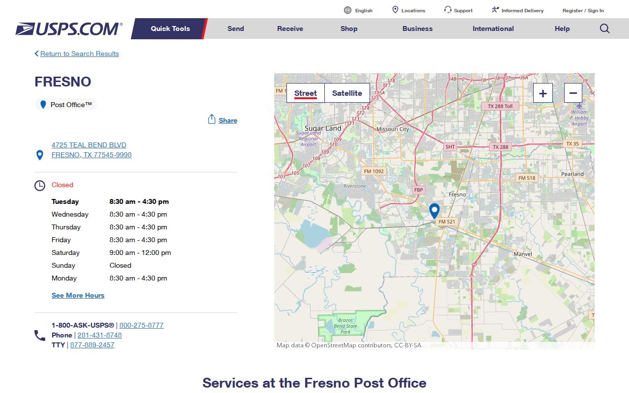
The USPS location view supports the documented 77545 anchor. Use the separate USPS address lookup before relying on that anchor for a specific address, business, or rural delivery point.
Teal Bend Boulevard also marks the western side of the county's Fresno study area. That civic reference is helpful for orientation, but it is not a substitute for the parcel map, street range, or address-level postal result.
Fresno ZIP Search Fields
The USPS ZIP Lookup offers three ways to normalize postal geography. Select the mode that matches the information already in hand. A returned ZIP helps format a search for Fresno records, but USPS specifically warns that its result does not confirm a person or company at an address.
| Search mode | Fields captured | Best use |
|---|---|---|
| Address lookup | Street Address, optional Company, City, State | Check the mailing ZIP for one stated address. |
| City and state lookup | City, State | Start with a postal-place question, then verify the address. |
| Cities by ZIP | ZIP | See the postal city labels associated with a ZIP. |
Write down the result exactly, including directional words, abbreviations, and any ZIP+4 returned by the service. A difference between a mailing label and an appraisal address is worth checking, not silently merging.
Note: A USPS ZIP result standardizes mail routing, but it does not verify occupancy, ownership, membership, or a legal municipal boundary.
Find Fresno Residents by ZIP Code
A ZIP code is most useful as the first sorting step, not as a complete resident list. Fresno searches work better when the postal answer is paired with a street number, a parcel identifier, or a subdivision name. The county systems divide their information differently, so the workflow keeps the source purpose clear.
- Use USPS to confirm the ZIP for the full address, rather than guessing from the postal city alone.
- Check the Fort Bend County street-range file for the road, address range, ZIP, precinct subdivision, and municipality code.
- Search the normalized street number and street name in Fort Bend Central Appraisal District. Its documented fields include owner name, situs address, owner mailing address, legal description, Quick Ref ID, and Geographic ID.
- For civic registration questions, use the individual Fort Bend Voter Registration Inquiry with its documented name, birth-date, or VUID methods. A broader Texas voter-file request uses county, district, or precinct reductions, not a captured ZIP query.
FBCAD's documented search form has street and subdivision fields, but the research did not capture a ZIP-only FBCAD search. Start with the address returned by USPS instead of claiming that the appraisal roll can generate every record in 77545. Once a ZIP narrows the area, the Fresno street directory handles the full address-by-address trail.
Fresno ZIP Edge on Trammel Road
Trammel Fresno Road is the local warning against treating a road name as a boundary. The 2025 county street-range PDF shows one 130-1843 segment with Fresno and 77545 coding, then a 4203-4522 segment with 77459 and Missouri City coding. A record search should therefore use the actual street number and range before assigning a postal city or jurisdiction.
This distinction matters when a deed uses a legal description, an appraisal account uses a situs address, and mail uses a postal city. The labels can all be accurate while describing different systems. Keep their original wording in research notes, then use the county parcel and street-range data to compare them.
Fresno ZIP and Subdivision Names
A Fresno ZIP code may be too broad for a deed or plat search. The county's Livable Centers material distinguishes older linear development called Old Fresno from newer subdivision areas, including Teal Run and Andover Farms. That difference changes the useful follow-up term: a newer parcel may respond to subdivision, lot, block, or section language, while an older tract may require a road, abstract, survey, or legal description.
The Fort Bend interactive map provides parcel, subdivision, CAD, MUD, thoroughfare, floodplain, and mobility layers. Search the address, review the parcel context, then carry the exact legal description to the County Clerk when a recorded document is needed. The live research did not capture a verified GIS ZIP-selection tool, so map browsing and address search remain the documented method.
Note: A subdivision name can refine a Fresno record search, but it should be checked against the parcel and recorded plat before drawing conclusions.
Fresno Postal Boundary Terms
Fresno is a CDP in Fort Bend County, not an incorporated city. Its Census boundary does not match a USPS delivery boundary, an election precinct, a school district, or a municipality code. County elections also cautions that district data changes, which is another reason to confirm current precinct information instead of reading it from a ZIP code.
- ZIP vs ZIP+4
- A five-digit ZIP directs mail to a broad delivery area. ZIP+4 adds a smaller delivery segment and does not create a parcel boundary.
- PO Box ZIP
- A ZIP used for post-office boxes can differ from the delivery ZIP for a physical address.
- Unique ZIP
- A ZIP assigned to one organization or destination. The research did not identify a unique Fresno ZIP.
- Carrier route
- A postal delivery grouping. It is a mail-routing term, not a resident roster or a legal jurisdiction.
A county Engineering address-verification process begins with CenterPoint Energy for a new or changed address. Engineering does not hold parcel ownership, so ownership questions still belong with FBCAD and, where needed, the County Clerk's recorded documents.
Fresno ZIP Area in Context
Fresno's Census QuickFacts profile reports 24,486 residents in the CDP for 2020 and 8.52 square miles of land area. Those figures describe the Census place, not the total population behind a postal ZIP. The same profile reports 78.9 percent owner occupancy for 2020-24, which is a broad area statistic rather than evidence about any individual parcel or household.
That scale helps explain why a single ZIP code directory result must be refined. A postal label can cover many addresses, while the records that matter may be organized by parcel, legal description, street range, precinct, or subdivision. Use the ZIP to orient the search, then retain the more precise record identifiers.
Fresno ZIP and Precincts
A Fresno ZIP code does not lock an address into one election precinct or district. The county street-range material places ZIP, precinct-subdivision, and municipality-code information beside road ranges, while the county's current election notice cautions that older third-party district data can be outdated. A ZIP may remain unchanged even when the applicable precinct or district changes.
Use the Fort Bend Elections and Voter Registration page for its current-data warning and routes to the Voter Precinct Interactive Web Map and View My Registration. For an individual record question, use the county inquiry method and enter only the information its selected method calls for. The voter file never reveals how a person voted, and protected fields stay outside ordinary web display.
This is another reason to preserve four labels separately: postal ZIP, parcel situs address, legal description, and election context. Each may be useful in Fresno research, but none replaces the others.
Note: A current election label helps route voter questions but does not replace the parcel and postal checks used for Fresno research.
Fresno ZIP Privacy Limits
Public availability has limits. Texas law and county practices protect fields such as Social Security numbers, driver-license numbers, birth dates, protected addresses, victim identifiers, and ballot choices. A voter record is civic-registration evidence, not a household census, and an FBCAD owner name is not proof that the owner lives at the parcel. Do not treat a delivery ZIP as personal identity evidence.
The Texas Address Confidentiality Program provides substitute-address protection for qualifying participants. Public index access never authorizes publication of protected information or unwanted contact with a person.